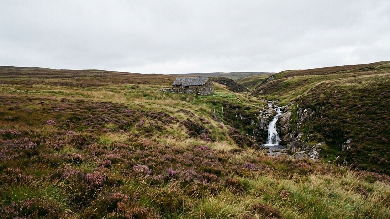
Most people arrive expecting a smaller, damper version of the Lake District and find something else entirely. The North Pennines is a high, open plateau with very little rock scenery on it. There are no lakes to speak of, few trees above 1,200 feet, and the horizon is usually a long brown line rather than a peak. Alston sits at about 1,000 feet and calls itself the highest market town in England. Great Dun Fell, with its white radar sphere visible for thirty miles, tops out at 2,782 feet. What fills the space between is grass, heather, blanket peat, and the wreckage of an industry that employed thousands of people up here and then stopped.
That wreckage is the point of the week. Lead was taken out of these hills for centuries, and the ground still shows it: hushes, which are artificial gullies cut by releasing dammed water down a hillside to strip the soil off the vein, and which from a distance look like landslips; horse levels driven straight into the fell; crushing floors; chimneys running uphill from smelt mills so the fumes could be condensed and the lead recovered from them. Killhope in Weardale keeps a working waterwheel thirty four feet across. Nenthead, a couple of miles from the Cumbrian border, was a whole village built by a mining company for its workers.
The other half of the ground is emptier and easier to walk past. The hay meadows in Teesdale and along the South Tyne are among the last unimproved upland meadows in England, cut late so the seed drops, and in early June they carry wood cranesbill, melancholy thistle, globeflower and eyebright at a density that no longer exists in most of the country. They are worked land, not a nature reserve, and if you walk through one before the cut you are walking through somebody's crop.
- What the week is
- Nine nights in three villages, four nights in the first and two and three after, in family run inns and a converted farmhouse, with a local driver moving the party and the luggage between them so walking days start and end without a pack.
- What sets it apart
- The nearest usable airport is Newcastle, and the drive from there is two hours to Alston. Rail reaches Penrith on the west and Darlington on the east, and both are still an hour by road from the beds. The ground is peat, tussock grass, limestone pavement and old spoil heaps rather than graded path, and it drains badly. Beds are inns with six to eleven rooms. The season runs mid April to late October, and outside it the high roads close on short notice. From $2,340 per person, two sharing.
- What the figure covers
- Nine nights in family run inns and one converted farmhouse, two people sharing; breakfast every morning; two evening meals in Alston and one at the farmhouse; all luggage transfers between the three villages; two full days with a walking guide who works this ground; one afternoon underground at a preserved lead mine, with lamp and helmet; return road transfers between Newcastle airport or Penrith station and the first bed; a printed route pack with grid references and the escape lines off each moor; and a named person at this office contactable in writing across all seven days.
- What it leaves to you
- Flights of any kind; six evening meals, which run $22 to $45 a head in the villages; all lunches, though inns will make a packed one for about $12; drinks; the local bus if you use it on free days, $4 to $9 a journey; taxis on the days the guide is not with you, commonly $30 to $60 each way because the villages are far apart; entry to the two smaller heritage sites, $9 and $14; walking boots, waterproofs and a compass, which are your own problem; single occupancy, which adds $560 across the nine nights; and anything you decide to add once you are there.
- Who this one is wrong for
- Do not book this if you cannot manage six to seven hours on foot over ground that is never flat and often ankle deep in wet peat, with 1,600 to 2,400 feet of ascent on the two guided days. Do not book it if stairs are difficult: three of the four buildings have bedrooms only on upper floors and no lift. The mine afternoon involves 300 yards of level walking underground at about 47 degrees, with a low roof in two places, and there is no way to shorten it once you are in.
Peat, weather from the west, and how a day here actually goes
The ground drains badly by design. Blanket peat holds water for weeks after rain, and the standard walking surface up here is a mix of tussock grass, wet moss and short bilberry, with occasional limestone underfoot where the ground rises. Boots come off wet most evenings. There is no path network in the sense that a person used to graded trails would recognize: there are lines that people take, which are sometimes marked and sometimes only a slight thinning in the heather.
Weather arrives from the west and arrives fast. Cross Fell, the highest ground in the range at 2,930 feet, generates the Helm Wind, the only named wind in England, when air spills over the escarpment and roars down the western side under a bar of stationary cloud. It can be still in Alston and unwalkable on the tops on the same afternoon. Summer daytime temperatures on the high ground sit around 52 to 63 degrees, and it is common to lose ten degrees walking up 800 feet into wind. Rain of some form falls on roughly two days in three across the year.
A guided day starts at nine, goes six to seven hours with a stop for whatever you carry, and gets back to the village between four and five. A free day is shaped by the bus, and the bus is the thing that decides your options. Weardale and the South Tyne valley have services, but two or three a day on some routes, none at all on Sundays on others, and the timetable does not connect the two valleys except by a long way round. Taxis exist and are not cheap, because the driver has to come from somewhere.
Who gets a good week out of this, and who does not
This suits somebody who is content to be out for a whole day with weather in their face and something industrial and slightly grim to look at. It rewards curiosity about how the ground was worked more than it rewards views. Walkers who want to arrive somewhere spectacular each afternoon will find the tops a long way from anything sharp. One person travelling on their own does well here: the inns are small, the bar is where everybody sits, and two of the three keep a table for people eating alone.
It also survives the calendar better than most walking weeks in England. The meadows are best in June, the mining sites run to the end of October, and the ground is walkable well outside the summer if you accept a shorter day. Fixed dates are not a problem: the two guided days can sit anywhere in a nine night block, and the mine afternoon runs to a schedule the office books against.
Six cells, one for each obstacle, filled where this trip answers. Read the words below rather than the strip; the strip is a shorthand.
- The dates are fixed and short
- answers it. Everything else that answers it
- The party moves at two speeds
- does not. The two guided days move as one group over open moor, and there is no shorter loop back to the village for somebody who cannot do the whole distance. What does
- Nobody has done this before
- does not. The free days hand you a map, a bus timetable that thins to two services, and no one deciding for you. What does
- The free weeks are out of season
- answers it. Everything else that answers it
- One person travelling
- answers it. Everything else that answers it
What each part of the year takes and gives back
- Mid April to early May
- Ground still sodden from winter, ten to twelve hours of light, hill lambing under way so dogs are unwelcome anywhere. Empty inns and the lowest figure of the season, near the $2,340 floor. Mid May to mid June | The meadows come up and this is the only window for them. Long light, midges not yet serious, and the busiest weeks for beds: expect $2,700 to $2,900 and book the nine nights well ahead.
- Late June to July
- Meadows cut and the color goes out of the valleys. Warmest walking, up to 68 degrees on a good day, and the most reliable bus timetable of the year. Around $2,800. August | School holidays fill the valley beds and the roads carry more cars than the rest of the year combined. Weather no better than June. The office generally steers people away from these three weeks. September | The strongest month for this particular week. Heather over by early September but the light is long and low, the ground firms up, the crowds go, and the figure drops back toward $2,500. October | Days shorten to about ten hours, guided walks pull back to five hours, mining sites start closing mid month. Cold, clear, often the best visibility of the year. From $2,400. November to March | The office does not run this week. High roads close on short notice, several inns shut entirely, and the mine sites are locked.
The bus timetable is the real cost of the free days
The awkward part of this week is not the walking. It is that the North Pennines is a large area with a small number of people in it, and the public transport reflects that honestly. On the days the guide is not with the party, the range of what you can reach without a car narrows sharply. Two villages are twelve miles apart with no direct service between them. A journey that looks like twenty minutes on the map can be two hours and a change, or a taxi at $40 each way. People who assume they can improvise a day out from the door are the ones who end up disappointed, and the office would rather say so now than have it discovered on a wet Tuesday.
The second thing worth stating plainly is the mine. The underground afternoon is included and it is the part most people remember, but it is genuinely underground: a low roof in two places, standing water, a constant 47 degrees, and no shortcut back to daylight once the group is in. Anyone who has not been under before should assume they will find out how they feel about it about eight minutes in. If that sounds wrong, say so when you send the request and the office will build the week without it and adjust the figure. There is no penalty for asking.